- Screen Colours:
- Normal
- Black & Yellow
There are currently 4 footpaths and 6 bridleways in the parish of Eriswell
As the name suggests footpaths are for walking only while bridleways can be used for walking, horse riding and cycling.
A number of Eriswell Parish footpaths and bridleways link up with neighbouring parish footpaths and bridleways.
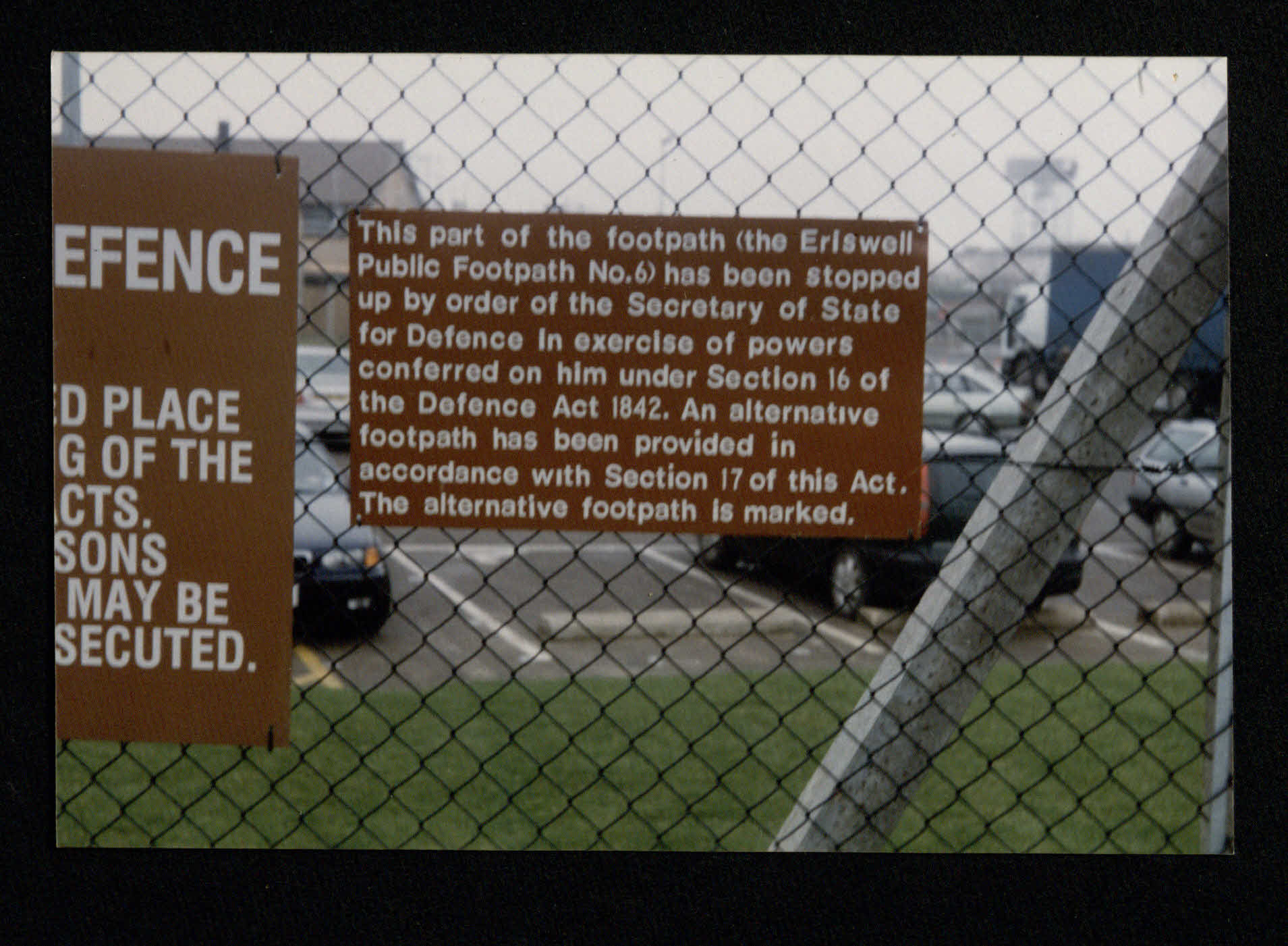
Footpath 10 was created after the MOD (Defence act 1842) stopped footpath 6 from passing through RAF Lakenheath.
The maps referenced on this site are derived from the Suffolk County Council Eriswell Parish definitive map (1985) (with hand written updates over the years). Suffolk County Council will in due course be re-releasing maps in elctronic form. This work is performed by the Rights of Way and Access team.
If you encounter a problem when walking a path, use this reporting tool to log it. The list of currently open problems is listed here.
Here is a Google Maps view of the parish boundary and all footpaths/Bridleways.
The Parish Boundary map show the extent of the Eriswell Parish)
Footpath 1 (KML), (GPX) or (PDF)
Footpath 2 (KML), (GPX) or (PDF)
Bridleway 3 (KML), (GPX) or (PDF)
Bridleway 4 (KML), (GPX) or (PDF)
Bridleway 5 (KML), (GPX) or (PDF)
Bridleway 6 (KML), (GPX) or (PDF)
Bridleway 7 (KML), (GPX) or (PDF)
Bridleway 8 (KML), (GPX) or (PDF)
Footpath 9 (KML), (GPX) or (PDF)
Footpath 10 (KML), (GPX) or (PDF)
ALL 10 in 1 ZIP file
Forestry England has a number of walking/Cycling paths a short drive away.